Showing posts with label PICTURE. Show all posts

December 22, 2012

Display of colonial Sudan in Durham, UK


http://www.soas.ac.uk/gallery/disappearingheritage/full75420.jpg

British and Egyptian flags flying in front 
0f a motor carriage used during the visit 
to Khartoum of Khedive Abbas Hilmi II. 
Photograph by R. Von Slatin, 1901


A series of photographs that capture the disappearing elements of Sudanese development in the 20th Century will be on display at Oriental Museum of the University of Durham, from January 1 - March 1, 2013.

Many culturally important buildings built during the rule of the British are slowly deteriorating due to neglect of maintenance.  They have been reused for other purposes. Some of the railway buildings have been abandoned to the desert. Frederique Cuventas captured many photos during a six year period up to 2010.

The exhibit is called: Disappearing Heritage of Sudan, 1820–1956: Photographic and Filmic Exploration in Sudan. It documents the remnants of the colonial experience in Sudan from the Ottoman, Egyptian and British periods.

This exhibition has previously been shown at the Brunei  Gallery at the University of |London, UK. For a few months, starting in September 2013, it will be shown at the University of Khartoum.


June 1, 2012

PICTURES: Suakin from the air

Been collecting these for a while, and wanted to share them with you. A selection of items found on the internet, to show you about the building structures on Suakin, from the early 1900s onwards. All photos will enlarge when you click on them.

Location of Suakin, south of Port Sudan   (1958)


Location of Suakin, south of Port Sudan   (1958)


Suakin 1981. looking northwest. Photo by Daniel Seerberger.


Suakin close-up 1981. looking southwest. Photo by Daniel Seerberger.


 Suakin looking northwest. Photo by pomkomGRB

Local fishing boats on the island south of the causeway. Photo by pomkomGRB


Looking east toward shipping channel from minaret?.
Article and photos about restoration of Suakin at International Business Times. October 2011.


Looking southwest from the minaret? on the island. 
Article and photos about restoration of Suakin at International Business Times. October 2011.

Looking east from mainland to the channel to the Red Sea.
Source unknown. Date 1930? WWII-1942?


Looking west. Photo by Colonel Hubbert. August 17, 1930. [More info]


Aerial photo uploaded at Beja Tribes of East Sudan. No date. 1930?


Undated, found at the rich photo site Skyscraper City.
Looking southeast - Red Sea in distance.


Modern satellite view, from google maps. May 2012. Large 1 megabyte file.


The Cousteau ship Alcyone picks her way through treacherous reefs to the abandoned port of Suakin, a city built of the same coral that guards her entrance. Uploaded August 2008. Aerial photo looks old, from an earlier era.


Movie made by a tourist. Includes historic illustrations. Uploaded January 2011.


MORE!!!


Photos of buildings in Suakin. [in English at Skyscraper City.]

Website about Suakin, showing black and white photos of buildings and giving a very short history of the place. Exciting!

May 17, 2012

PICTURE: Hadendowa man - sepia


From a 1920's postcard selling on ebay...

April 1, 2012

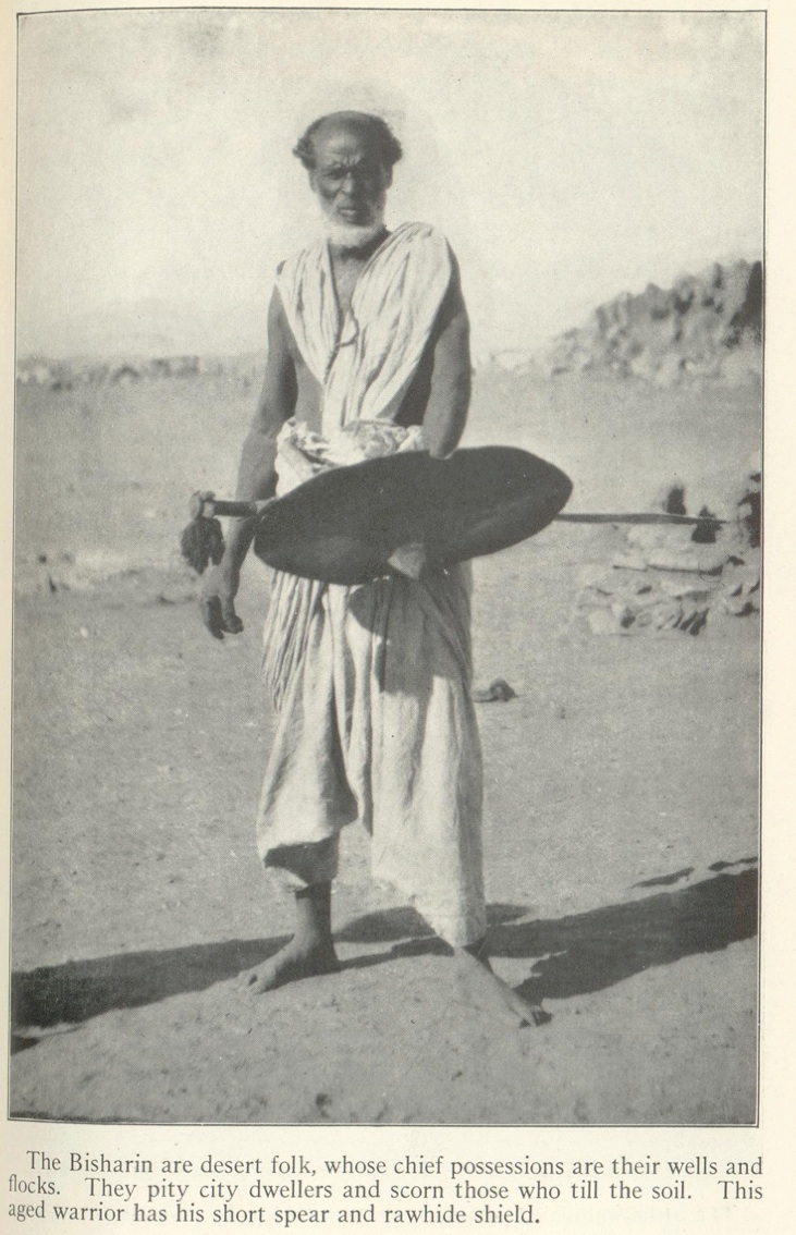
PICTURE: an older Bisharin warrior


Sourced from a United Nations World Digital Library. Cairo to Kisimu, by Frank Carpenter. page 220.

February 14, 2012

PICTURES: Diving in the Red Sea


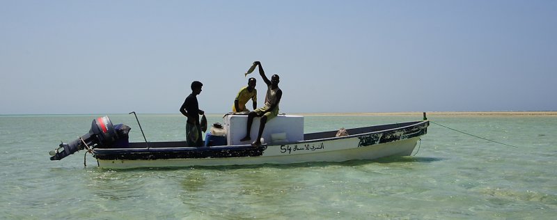
 Beja Fisherman, Red Sea. Terrence Weston photo.

Tourism is an important aspect of life for people living along the coast of the Red Sea. In egypt there is a well developed tourism industry, that is based on large hotels and resorts, with beaches, bars and night life.

In some places wilderness adventure and exploration of archeological sites and natural features are offered, but less people attend those.

And a few people love to dive into the beautiful waters of the sea, exploring ship wrecks and coral reefs.

The photo above comes from a large set of photos taken by Terrence Weston as he explored regions north of Port Sudan back in 2006, looking for suitable places to dive.

 Beja Fisherman load their catch onto ice.  Terrence Weston photo.

 Jazirat Bayer or  Shambayer. Terrence Weston photo.

December 3, 2011

PICTURE- traditional Beja clothing


Ahmed Said Abuamna, Beja man from East Sudan, photographed near Cairo, September 2011.

Musicians are seeking funds to launch a recording project of original Beja songs. Reported earlier on November 10.

UPDATE: Looks like they got all the funds they needed! Read about their recording project

November 7, 2011

PICTURE - Market in Shalateen, Egypt


Click to enlarge. Photo taken July 2011, by Yasser El-Rasoul

October 21, 2011

May 21, 2011

PICTURE: Bisharin man


Bisharin man at Aswan. Many universities have historic document collections. This photo [circa 1921] comes from the University of Cambridge in England.
via: http://bejapics.tumblr.com/page/2
original source at: http://www.dspace.cam.ac.uk/handle/1810/1339

March 2, 2011

PICTURE: Port Sudan Aerial Photo

Thought I'd offer our readers a new feature.

I've got a variety of photos of the Beja world - of Egypt, Sudan and Eritrea. They're from the internet, somewhere. I may not have sources for them- I'd love to credit you if you took the picture. Leave a comment.

The plan is to upload a photo to illustrate aspects of the world of the Beja people every now and again. It might not be news, but they certainly are interesting.  Enjoy!

Port Sudan Harbour, looking northwest. date 1995???


Compare with a map from 1946 by the [U.K.] Naval Intelligence Division